How to read a flood gauge
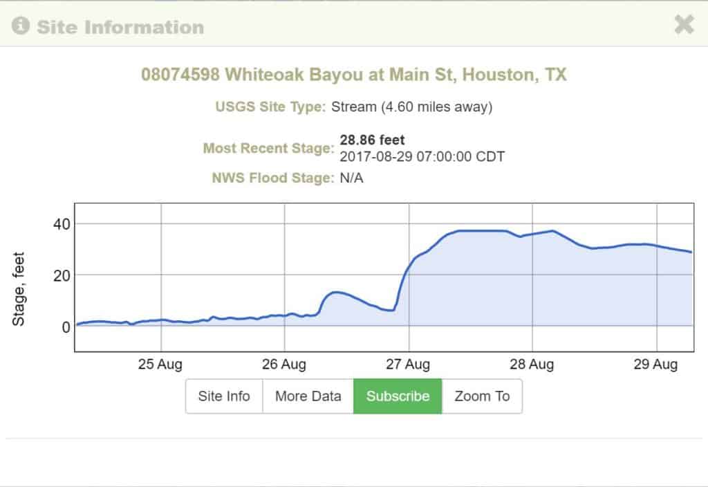
Since Harvey hit land, Houstonians have kept a constant eye on the Bayous. What are they doing, are they flooding, how much can they handle?
As kayakers, Kelly from Bayou City Outdoors and I frequently review the bayou flood gauges before kayaking events. Some kayakers seek higher water after rain fall for a little added excitement, while other times we are looking for lower levels for to teach beginners how to kayak.
So we thought we would show you where to find the water gauges and show you what to look for.
Below is an example of the discharge of the Brays Bayou. Discharge in Cubic Feet tells you the flow of the water. Each body of water can handle different levels of discharge. Therefore, you want to look at the history of discharge to know what’s normal.
The yellow triangles show you the 81-year average discharge.
So when we look at this chart below, we can tell the following:
- The bayou is flowing extremely higher than normal (we already knew that 🙂 )
- The blue line flattened out at the top. This indicates that the rain from the night of Aug 27th, didn’t significantly increase the amount of water.
What to look for: We want to keep an eye on the blue line. If it starts to go down, then water is receding in this particular area. You alway want to check the water levels of bayous that flow into the bayou near you. Your bayou might be receding now, but if a bayou that flows into yours is rising, you’ll likely see a rise later.
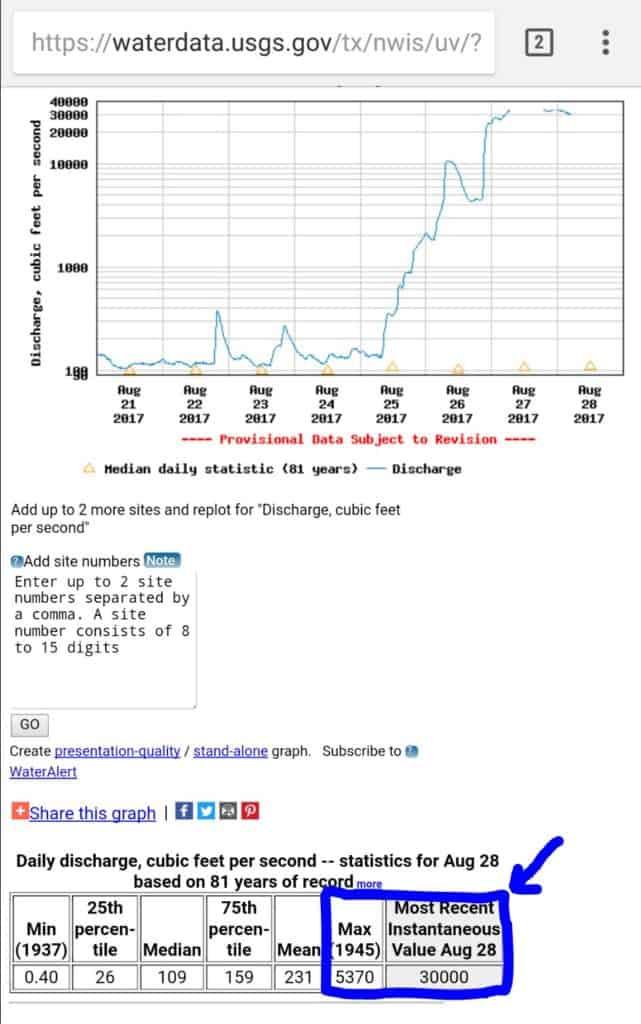
NOTE: The Max information on the chart above does not appear to be accurate.
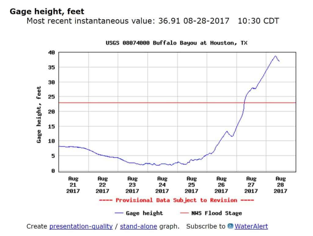
Guage Height in Feet:
The second graph is the height of the bayou. We use this graph a little more frequently because most of them tell you what height the bayou is flooding. Below is a graph of the Buffalo Bayou (Woodway to Sabine).
The blue line is the current height of the bayou and the red line is the flood level. Again, we are looking for trends and spikes. The bayou receded a little bit according to this gauge. That does not necessarily mean it will continue to recede. However, any receding water is appreciated. We’ll continue to monitor the water levels to know if the bayous are headed in the correct direction.
Other bodies of water and rain fall should also be monitored for a more complete picture. Don’t forget to listen to your local authories for immediate.
Find a Bayou Gauge Near you. (Be sure to check the location as there may be more than 1 gauge along each body of water.)
If you need help looking up a different county, please email me! amyhope@HTXoutdoors.com
Stay Safe! Turn Around, Don’t Drown!
NOTE: This article is information only and should not be relied upon to make major decisions. Listen to your local officials for recommended courses of action. Do research in multiple places for a full and more accurate view. Just because there is a dip/spike in the graph, doesn’t necessarily mean your safe or in danger. The water gauge is just one small source of information in the entire Harvey picture.

Responses